
Why you need a land surveyor in Ghana
When navigating the intricate landscape of land acquisition in Ghana, one pivotal figure stands out: the land surveyor. These skilled professionals play a critical role in ensuring that your land transaction proceeds smoothly and legally. But what exactly do they do, and what types of surveyors are there?
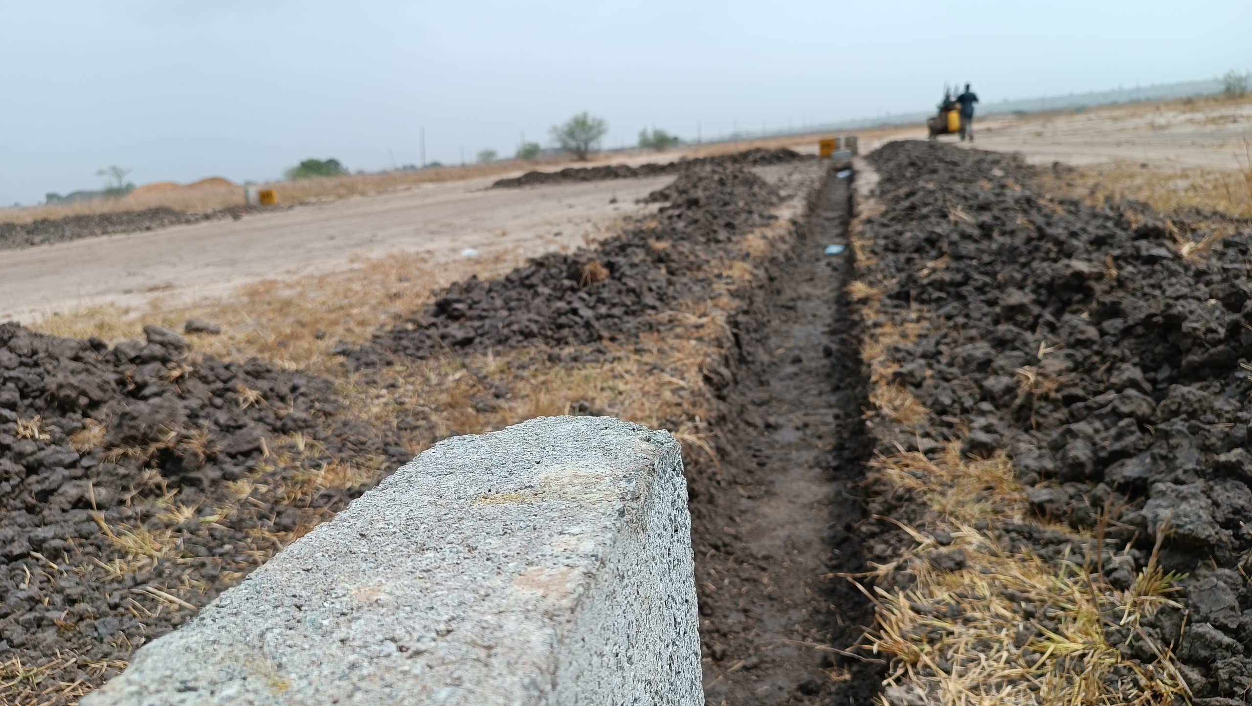
In Ghana, surveyors are instrumental in meticulously measuring and documenting the dimensions, contours, and attributes of land. This ancient craft, with roots stretching back to 4000 BC, has evolved into a vital component of modern property transactions, thanks in part to the Survey Act of 1962 (Act 127), which provides the legal framework for surveying practices.
Surveying is the process of accurately measuring and recording the size, location, and features of a specific piece of land. This information is then used to create a legally recognized document called a “site plan” that shows the exact boundaries of your property. The licensed people who produce these documents are known as land surveyors.
Site plans in Ghana are key for two reasons:
- Land Registration: It’s a crucial document for registering your land with the Lands Commission of Ghana, the official body that oversees land ownership. A professional surveyor will assist you with this entire process.
- Peace of Mind: Having a certified site plan ensures you know exactly what you’re buying. It eliminates any confusion about the property’s boundaries and helps prevent future disputes.
I can’t go through the entire land purchase process in Ghana here but you can always read about the comprehensive guide to buying land in Ghana. Let’s move on to the types of surveyors we have.
READ ALSO: Top Real Estate Developers in Ghana
Types of surveyors in Ghana
Surveying is a broad profession and there are many aspects to it. I’ll just highlight a few of them. Surveyors in Ghana are classified under GhIS and these are the major types of surveyors in Ghana, land surveyors, quantity surveyors and valuation & estate surveyors.
- Land Surveyors:
- Definition: Land surveyors are professionals who measure and map the environment using specialized equipment and techniques. They determine land boundaries, as well as the topography of the land.
- Roles and Responsibilities:
- Determining the exact boundaries of a piece of land.
- Providing data for construction projects, including building placements, roads, and utility lines.
- Creating maps and legal documents.
- Providing expert testimony in legal disputes over property boundaries.
- Skills Required: Strong mathematical and analytical skills, proficiency in using surveying equipment, knowledge of land laws and regulations.
- Quantity Surveyors:
- Definition: Quantity surveyors, also known as construction cost consultants or commercial managers, manage all aspects of the contractual and financial side of construction projects.
- Roles and Responsibilities:
- Estimating and controlling costs for construction projects.
- Preparing tender and contract documents.
- Advising on procurement strategies.
- Managing contractual relationships between stakeholders.
- Conducting feasibility studies and cost-benefit analyses.
- Skills Required: Strong numerical and analytical skills, knowledge of construction methods and materials, understanding of contracts and legal frameworks.
- Valuation & Estate Surveyors:
- Definition: Valuation and estate surveyors are professionals who provide valuation services for real estate properties and advise on matters related to property investment, development, and management.
- Roles and Responsibilities:
- Conducting property valuations for various purposes such as sale, purchase, mortgage, insurance, and taxation.
- Providing investment advice to clients regarding real estate assets.
- Managing property portfolios for individuals or organizations.
- Negotiating property transactions on behalf of clients.
- Conducting market research and analysis to determine property values.
- Skills Required: Knowledge of property markets and trends, strong negotiation skills, proficiency in property valuation methods and techniques, understanding of financial analysis and investment principles.
These are just a few vital areas but for most people that deal with land, the land surveyor is the most useful person to you when you are purchasing land in Ghana.
There’s also the valuer who is an expert in providing the market value of a property. It’s helpful for potential buyers, sellers and financial institutions who require the real market value of their property.
Now let’s talk about what land surveyors do on the land you intend to buy.
What do land surveyors do?
When buying property in Ghana from either a family, stool (chief) or government, you will need an indenture.
An indenture is basically a contract between the buyer and seller of a piece of land. This includes all the terms of the sale and the details about the land being sold. The indenture will normally have a site plan included but there are times that it is not.
Even if the site plan is included, it is wise as a buyer to create your own site plan with a professional land surveyor. This is because there are times when the site plan is not accurate as some people tend to use unqualified surveyors.
This can cause problems in the future so it is always advised to get your own site plan done. Some unscrupulous people intentionally add incorrect site plans to the indenture just to make a sale.
So to be safe, get a surveyor to generate a new site plan that can be submitted to the Lands Commission for processing. Once you get a surveyor, they will proceed with the following;
- Measurement: They use specialized equipment to precisely measure the distances, angles, and elevations of your land.
- Data Collection: They don’t just measure the edges. They also record any important features on the land, like buildings, trees, or bodies of water.
- Site Plan Creation: Based on their findings, they create a detailed map, the site plan, that depicts the property’s size, shape, and location according to Ghana’s legal requirements.
- Submission to Lands Commission: Once the site plan is ready, the surveyor then submits the plan to the Lands Commission. When submitted by a registered surveyor, you should expect a response from the lands commission within 3 – 8 weeks.
Types of Land Surveys
There are a variety of land surveys that can be done by a surveyor but in relation to buying a piece of land, the boundary survey is what is necessary. This is under the cadastral survey. This is the bread and butter of land surveying. It focuses on accurately determining the exact location and size of your property, and establishing its boundaries. This is crucial for registering your land and preventing future disputes with neighbours.
In Ghana, there are various surveys that you should be aware of such as;
1. Approved Site Plan
An approved site plan is a legally recognised document created by a land surveyor that depicts the exact measurements, location, and layout of a specific piece of land.
It’s like a blueprint for your property but with official approval from the government. Here’s a breakdown of what it is and why it’s important:
What it Contains:
- Property Boundaries: The approved site plan clearly shows the precise dimensions and border lines of your land. This eliminates any confusion about where your property begins and ends.
- Features: The plan may also include important features on the land, such as buildings, existing structures, wells, or natural features like streams or ponds.
- Compliance: It ensures your property layout adheres to local zoning regulations and building codes.
Getting an Approved Site Plan:
A licensed land surveyor can create a site plan for your property. They will conduct a survey to measure the land and then draft a plan based on their findings.
Once the plan is complete, it will need to be submitted to the Lands Commission for review and approval. This process typically takes several weeks.
By obtaining an approved site plan, you’re taking a crucial step towards securing your land ownership and ensuring a smooth path for any future development projects.
2. Certified Site Plan
The terms “approved site plan” and “certified site plan” are often used interchangeably, but there can be some subtle differences depending on the specific region or local regulations. Here’s a breakdown to clarify:
Approved Site Plan:
- This is the more universally recognized term. It refers to a legally recognised document created by a licensed land surveyor.
- The plan details the property’s measurements, location, and layout, including boundaries, features, and compliance with zoning regulations.
- Crucially, it has been reviewed and officially approved by the relevant government authority, typically the Lands Commission in Ghana. This approval makes it a valid legal document for land registration and development purposes.
Certified Site Plan:
- This term might be used to emphasize that the plan was created by a qualified professional, a licensed land surveyor. Their stamp or signature certifies the accuracy of the measurements and adherence to surveying standards.
- Approval from a government body might not always be explicitly mentioned when referring to a certified site plan.
Here’s a table summarizing the key points:
| Feature | Approved Site Plan | Certified Site Plan |
| Created By | Licensed Land Surveyor | Licensed Land Surveyor |
| Content | Measurements, Location, Layout, Compliance | Measurements, Location, Layout |
| Requires Approval | Yes (by Lands Commission) | May or may not be explicitly mentioned |
| Key Purpose | Land Registration, Development Projects | Verification of Accuracy by Professional |
In essence, an approved site plan is a certified site plan that has received the official government stamp of approval.
For most purposes in Ghana, you’ll likely be looking for an approved site plan to ensure your land ownership and development plans proceed smoothly. A licensed land surveyor can guide you through the process and ensure your plan meets all the necessary requirements.
How to get a Licenced land surveyor in Ghana
All surveyors in Ghana must be licensed by the Ghana Institute of Surveyors (GhIS). If you want to work with a surveyor that does not have a licence from GhIS then you do so at your own risk. How much does it cost to survey land in Ghana you might ask? It really depends on various factors like the size and location of your land, the type of survey needed and the experience of the surveyor. Surveying fees can range from Ghc 1000 (appr. $90) to Ghc 20,000 (appr. $2000) per survey for a 100×70 plot of land.
So how do I choose a surveyor? You can get in touch with our team of surveyors by filling out a form to get an estimate within 24 hours. These are licenced surveyors in Ghana whom we strike exclusive deals with so you get what you need as well as expert guidance and coaching along the way.
I hope this has been useful and please feel free to share this with a friend. Getting a surveyor in Ghana is not as difficult as many believe. I always advise you to work with professionals who can give you exactly what you need.